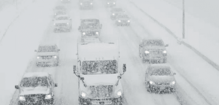
[vc_row][vc_column][vc_column_text dp_text_size=”size-4″]CHICAGO: A significant winter storm that hit the Northern Plains and Upper Midwest on Wednesday caused hundreds of schools to close, grounded flights, and made travel challenging, if not impossible, in several parts of the US.
As the storm rolled across a sizable portion of the western and northern United States and into the East on Wednesday morning, more than 50 million Americans were under winter weather advisories. In certain areas, the National Weather Service predicted gusts of up to 60 miles per hour and snowfall of up to 2 feet (60 cm) over the day and into Thursday.
In Sioux Falls, South Dakota, some 17 inches (43 cm) of snow, wind gusts up to 45 mph (72 kph) and temperatures hovering around 10 degrees Fahrenheit (-5 C) punished those going about their daily routines.
“It’s really cold, but people still want their coffee and eggs,” said Bre Bethke, 37, a manager at M.B. Haskett Delicatessen, after being blasted by the fierce weather each time she opened a drive-through window for a waiting customer.
“Our regulars want to come here and get out of the cold. But not today, no way. This is too much.”
The storm also pounded California and brought a mix of snow and sleet to the East, including New England, where forecasters warned motorists to beware slick roads.
Snow-covered roads also will make travel treacherous in the Upper Midwest, and ice-covered power lines and falling trees could cause power outages late on Wednesday and into Thursday, said Frank Pereira, a forecaster with the weather service’s Weather Prediction Center in College Park, Maryland.
“Travel will be near-impossible,” he said.
According to experts, excessive heat and dry spells, interwoven with increasing numbers and intensities of these storms, are signs of a changing climate. According to the weather service, the Northern Plains have had an extraordinary winter in terms of snowfall and temperatures, in contrast to the East Coast’s comparatively mild winter.
Minneapolis was one of the Midwest’s hardest-hit cities. There was expected to be whiteout conditions due to the 20 inches (50 cm) of snow and the 45 mph (72 kph) gusts.
At a press conference, St. Paul Mayor Melvin Carter stated, “We are prepared for what is likely to be one of the greatest snowstorms in Minnesota history.”
Emergency situations were proclaimed in Minneapolis and the neighbouring city of St. Paul, and drivers were advised to stay off the roads.
Minneapolis’ school system said it would hold classes remotely for more than 29,000 pupils for the rest of the week. Dozens of school districts canceled classes in the Dakotas, Colorado and Wyoming.
The storm wreaked havoc on morning air travel. Some 3,500 flights were delayed or canceled across the nation, including 470 flights into and out of Minneapolis, according to Flightaware.com.
According to the weather service’s Pereira, it also created a zone of freezing rain that stretched from central Iowa through Chicago and into southern Michigan, coating roads, trees, and power lines with up to a 1/4 inch (0.6 cm) of ice.
Tuesday saw the storm make landfall in California, and it was predicted to last through the end of the week. The first warning from the meteorological service since 1989, a rare snowstorm was issued for the mountains in Los Angeles County.[/vc_column_text][/vc_column][/vc_row]


