The Space and Upper Atmosphere Research Commission (Suparco) announced on Saturday that Pakistan’s newest remote-sensing satellite has successfully entered orbit following its launch from China’s Xichang Satellite Launch Centre last month.
In a statement, Suparco confirmed that the satellite has established stable communication with ground stations and has already started sending high-resolution images. Officials said the development will greatly enhance data availability and accuracy for several national sectors.
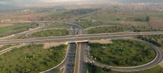
Equipped with advanced imaging systems, the satellite will support urban and regional planning by tracking city expansion and infrastructure growth. It will also play a vital role in disaster management, providing early warnings and rapid response tools for floods, earthquakes, landslides, and other natural disasters. Additionally, it will aid environmental monitoring by observing glacier melt, deforestation, and climate-related changes.
As Pakistan’s second remote-sensing satellite after PRSS-1, it is also expected to benefit agriculture by enabling precision farming, mapping crop cycles, and improving water resource management—boosting national food security.
Suparco stated that these upgraded capabilities will strengthen decision-making in multiple sectors, foster sustainable socio-economic progress, and further advance Pakistan’s technological self-reliance.
Few days earlier, Pakistan Successfully Launched Advanced Remote Sensing Satellite